Menu Close

An Eventful Start to the Fire Season on the East Coast

Tahiry Rabehaja and Stuart Browning
 

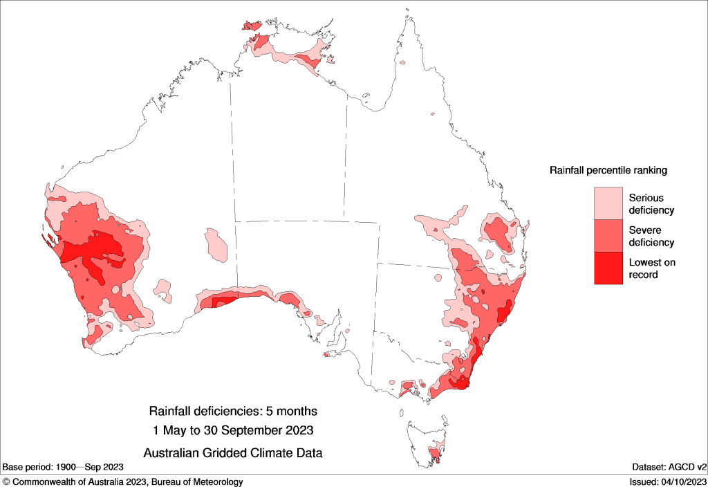
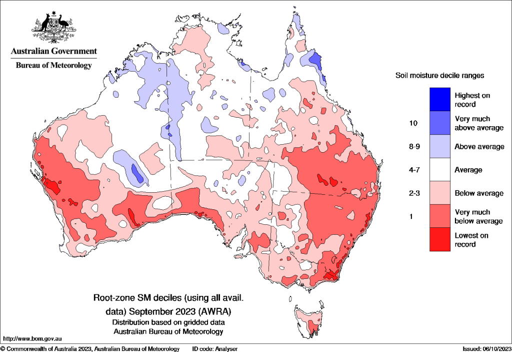
The 2023-2024 bushfire season has arrived early for southeast Australia. After the driest September on record, October began with multiple fires raging simultaneously across New South Wales and Victoria. Catastrophic bushfire weather and the destruction of multiple houses in the Bega Valley region has seemingly confirmed predictions that Australia is facing a potentially dangerous bushfire season.

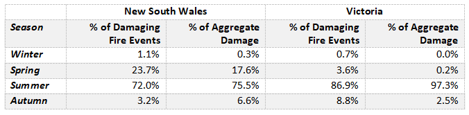
Although this start of the fire season is in line with The Bureau’s broad classification of fire danger seasons in Australia, we have been accustomed to expecting large fires impacting southern New South Wales and Victoria during the peak of summer months rather than early spring. Table 1 shows the seasonal breakdown of past damaging bushfires recorded in Risk Frontiers’ natural catastrophe impact database, PerilAUS. The count column represents the share of number of fires that are recorded to have damaged a property or caused injuries occurring in New South Wales and Victoria for each season. The damage column estimates the aggregate impact of fires for each season and is computed using PerilAUS’ House Equivalent (HE) metric. In Victoria (and southern New South Wales to a certain extent), the table shows a share of around 4% of damaging bushfires for spring when we look at the historical data. Moreover, spring fires are clearly associated with a much smaller share of the damage in that region of Australia.

This briefing note examines some of the large fires that have already occurred in the southeastern region of Australia, and what this might mean for the rest of the fire season.

Table 1. Seasonal breakdown of damaging events recorded in PerilAUS from 1900 to 2022, for New South Wales and Victoria[ These percentages may not sum up to 100% due to rounding. ].

The Coolagolite fire

The Coolagolite fire, on October 3, 2023, necessitated the evacuation of residents in the affected areas shown in Figure 1. The fire started and spread through the Bermagui Nature Reserve, with initial containment efforts by the RFS facing significant challenges due to a perimeter exceeding 40km. Figure 1 illustrates the approximate current fire footprint (yellow) and its status 24 hours prior (orange). These containment efforts were further hampered by strong wind gusts, reaching speeds of up to 90km/h.

There have been reports of damage, with some newspapers referencing it as occurring “near the New South Wales coastal town of Bermagui.” When we overlap the approximate fire footprints taken from the RFS website with Risk Frontiers’ potential fire damage summary from the FireAUS 4 catastrophe loss model, it becomes apparent that the affected homes are more likely situated within the Barrangga Bay and Cuttagee areas. Figure 1 depicts this information using pixelated shades of red to indicate the location of vulnerable Geocoded National Address File (GNAF) address points at a 100m resolution and assigns a location risk value between 0 to 1 based on various risk factors such as distance to bushland, surrounding vegetation and building, effective slope, among others.

Figure 1. An approximate footprint for the Coolagolite fire. The orange polygons estimate the burnt area 24 hours prior, and the yellow polygons estimate the current footprint (October 4). The red-shaded pixels represent 100m areas containing at least one GNAF, and the shade of red colour indicates the average risk of damage within that pixel. Fire polygons were sourced from the RFS website (accessed 4/10/2023).

The Briagolong and Loch Sport fires

Victoria has also experienced at least two large bushfires early in the fire season, with notable incidents including the Briagolong and Loch Sport fires, both of which prompted evacuations on October 2. During the Briagolong bushfire, an off-grid mudbrick home on Duffy Road was destroyed.

A southerly wind brought some much-needed rain on the night of October 3, which has aided in containing and suppressing these fires.

Figure 2. Approximate footprints for the Briagolong and Loch Sport fires. The orange polygons estimate the burnt area 24 hours prior, and the yellow polygons estimate the current footprint (October 3). The red-shaded pixels represent 100m areas containing at least one GNAF, and the intensity of red colour indicates the average risk of damage within that pixel. Fire polygons were derived from FIRMS/NASA (accessed 4/10/2023).

The weather underpinning these fires and the expectation for this season

During the “Black Summer” fires, it was observed that the fires “moved” southward. Major damage occurred in northern New South Wales in October 2019, specifically in areas like Drake to Rappville. Subsequently, the devastation on the south coasts was sustained in December and January 2020, affecting regions from Greater Sydney to the Victorian border. This is typical bushfire behaviour because peak bushfire season at any given location generally corresponds to the driest time of year: for northern Australia it is late winter; for the Sydney region springtime; and for southeast New South Wales and Victoria it is mid-Summer.

Figure 3. Rainfall deficiencies for May to September 2023, highlighting the extreme dry conditions experienced across southeast Australia. Source: http://www.bom.gov.au/climate/drought/#tabs=Summary
Figure 4. Root zone soil moisture deciles for September 2023, highlighting the extreme landscape desiccation across southeast Australia leading up to the October 2023 bushfires. Source: http://www.bom.gov.au/climate/drought/#tabs=Summary

While there are legitimate concerns about increased vegetation and fuel loads following 3 consecutive La Niña years, the primary drivers of catastrophic bushfires are hot dry winds blowing over a dry landscape. During winter and early spring 2023, Victoria and southeast New South Wales experienced some of the driest conditions in Australia, with Figure 3 showing severe rainfall deficiencies. Soil moisture deficits are a key indicator of landscape dryness and are used in the calculation of the Forest Fire Danger Index (FFDI). Figure 4 shows that for the bushfire-affected regions of Victoria and New South Wales, September soil moisture deficits were the lowest on record.

Dry conditions and elevated bushfire risk across southeast Australia are not unexpected, given the hot dry weather experienced over recent months, and are consistent with the climatic influence of the current positive Indian Ocean Dipole (IOD) event. IOD influence usually peaks during spring, and the current forecast is for the IOD index to return to near neutral values by late summer. Heavy rainfall across southeast New South Wales in the first week of October has eased localised rainfall and soil moisture deficiencies and should also reduce the level of bushfire risk. Although El Niño has been declared by the Bureau and is forecast to continue until at least Autumn 2024, the seasonal rainfall outlook is pointing to average or above average rainfall for most of New South Wales, providing some hope that the bushfire season might not be that bad after all.

Conclusion

In summary, the early onset of the bushfire season in southern New South Wales and Victoria has sparked concerns about the upcoming fire season and beyond. The accumulation of fuel during three consecutive La Niña years has become desiccated during the driest September on record. Although recent heavy rainfall has temporarily reduced the risk, and the seasonal rainfall outlook is relatively benign, there remains a potential for more severe bushfires in the near future. State agencies are taking proactive measures to prepare for these challenges, including enhancing emergency management and fuel management through hazard reduction burning. In fact, it has been reported that the New South Wales Rural Fire Services is “in a better position to combat the bushfire season compared to the Black Summer fires.” 

Historically, the occurrence of large, damaging fires in southern New South Wales and Victoria typically aligns with the peak of the fire season, which traditionally falls during the summer months (see Table 1). In the backdrop of a changing climate, there is a growing expectation that fire seasons will become not only hotter but also longer, thus potentially stretching and intensifying the peak fire danger seasons. 

Reference

 Cai, W.,  Cowan, T., and  Raupach, M. (2009),  Positive Indian Ocean Dipole events precondition southeast Australia bushfires, Geophys. Res. Lett.,  36, L19710, doi:10.1029/2009GL039902.


About the author/s
Principal Software Engineer at Risk Frontiers | Author Profile | Other Posts

Tahiry is a Software Engineer with years of experience working with multiple operating systems, container technology, programming languages and various software stacks. Tahiry holds degrees in Mathematics and a PhD in Computer Science.

Stuart Browning
Climate Risk Scientist at Risk Frontiers | Other Posts

Stuart is Risk Frontiers' Climate Risk Scientist, with extensive experience studying the weather and climate in Australian and the Asia-Pacific region. His focus is to understand the large-scale climatic drivers of extreme weather events to better quantify risk over seasonal to multi-decadal timescales, using reanalysis data, model simulations, and paleoclimate records.

Interested in Learning More About Our Detailed Australian Bushfire & Grassfire Loss Model?

The latest release of FireAUS, modelling bushfire and grassfire risk across Australia, represents another leap forward in the quantification of risk at the location and portfolio level. Risk Frontiers are the local, Australian-based experts and have used our recognised artificial intelligence, machine learning and climate modelling capabilities, decades of peer reviewed research and on the ground post-event surveys to continue to evolve our leading edge fire loss model.

Soon to be released FireAUS 4.0 will continue from FireAUS 3.2’s Australia wide coverage at the individual address level and can report losses at address level, SA1, postcode, and Cresta zones.

Our team is ready to answer your questions.